Tuesday, October 9, 2012

The North Cascades Get Wilder

The new Thunder Creek Wilderness Area.
Image courtesy of National Park Service
Posted by Sarah Krueger, Public Lands Programs Manager

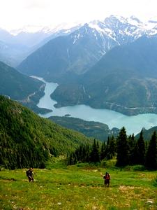
The North Cascades just got a little wilder.  On September 14, Secretary of the Interior Ken Salazar administratively added 3,559 acres of Wilderness to the Stephen Mather Wilderness area, which includes parts of North Cascades National Park and Ross Lake and Lake Chelan National Recreation Areas.  The newly protected area encompasses the Thunder Creek valley follows Thunder Arm of Diablo Lake, harbors lush low-elevation old-growth forest, and provides shoulder-season hiking opportunities out of the Colonial Creek Campground.
The Washington Parks Wilderness Act of 1988 originally identified the Thunder Creek Valley as potential wilderness, but the area was not federally protected due to plans by the City of Seattle to harness Thunder Creek’s aquamarine glacial waters for hydropower development.  However, the 1988 act that created a swath of protected wilderness areas within Olympic National Park, Mount Rainier National Park and North Cascades National Park Service Complex, also included a provision that the Thunder Creek Potential Wilderness Area could be could be administratively designated at the direction of the Secretary of the Interior, if and when non-conforming uses are terminated.  Since the City of Seattle abandoned plans to develop hydropower on Thunder Creek, and with no other uses planned for the area, the Secretary was able to designate this area as Wilderness, as directed by the 1988 Washington Parks Wilderness Act.   

The Mountaineers, along with 12 other conservation and recreation groups representing Washington State, sent a letter to Secretary Salazar, supporting an administrative decision to designate Thunder Creek as Wilderness. The wilderness addition marks the first lands managed by the National Park Service that have been added to the National Wilderness System in 14 years in Washington State.

Monday, October 8, 2012

Wildfires continue to affect Eastern Washington trails and forests

As most of us have been enjoying late summer sunshine and blue skies over on the Western side of the state, our fellow residents in Eastern Washington have been fighting wildfires. Lack of rainfall and severe lightning has resulted in over 100 wildfires in Yakima, Kittitas, Chelan, and Okanogan Counties.
Okanogan burn area

The National Weather Service has issued a Red Flag for much of Western Washington and Oregon as well due to historically dry conditions.
Since initial lightning storms in early September, many roads, trails and large areas of forest have been closed to recreation. As several of the wildfires become better managed or contained closure boundaries are being changed. Before heading to your destination east of the Cascade Crest check on the latest fire updates at www.fs.usda.gov/okawen.

Active fires in the Entiat and Wenatchee River Ranger Districts mean several key access roads and trails remain closed. Just south of Leavenworth, the 2,609 acre Cashmere Mountain Fire in the Alpine Lakes Wilderness has been closed.

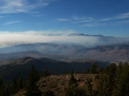
Monitoring a controlled burn at Table Mountain
Closures are still in effect for the following areas near the towns of Wenatchee and Cashmere, including Mission Ridge, Beehive Reservoir and Devil's Gulch. These closures are along the boundary lines of the Table Mountain Fires within the Cle Elum Ranger District.


Entry into closed areas by anyone other than law enforcement or firefighters into these closed areas may result in a fine up to $5,000 and/or imprisonment.

Please consult your local Ranger District for closures and updates, and information on ways you can give your support to firefighting efforts.
 

Methow Valley Ranger District at 509-996-4003
Tonasket Ranger District at 509-486-2186
Chelan Ranger District at 509-682-4900
Entiat Ranger District at 509-784-1511
Wenatchee River Ranger District at 509-548-2550
Cle Elum Ranger District at 509-852-1100
Naches Ranger District at 509-653-1401
Okanogan-Wenatchee National Forest Headquarters at 509-664-9200


Visit the Okanogan-Wenatchee National Forest website for up-to-date information at http://www.inciweb.org/state/49/


DNR Fire Alert http://fortress.wa.gov/dnr/firedanger/BurnRisk.aspx

Wednesday, October 3, 2012

Tracking Invaders from Stevens to Snoqualmie


By Andrew Allison and Aaron Hunter

By way of introduction, Aaron and I are Habitat Restoration Technicians recruited by The Mountaineers for an 8-day expedition survey to identify invasive and non-native plant species in the Alpine Lakes Wilderness.   Our task was to supplement the volunteer efforts of the Alpine Lakes Weed Watchers Program by surveying an iconic, high-priority trail: the entire Pacific Crest Trail from Stevens to Snoqualmie Pass. 

I have logged multiple backpacking expeditions within the Appalachian Range and the Cascades, and Aaron has spent time exploring the wilderness in Jamaica and the Olympic Peninsula, but the experience before us became a trip all to itself. Armed with five maps, four shoulders sagging under 65-pound packs, two GPS units, and one fly rod, we set off from Stevens Pass for a 75-mile climb toward Snoqualmie.

Our first two days were beautiful September gems: blue skies, warm sun, and no appreciable humidity. We spent one night at Mig Lake and went as far as Deception Lakes on day two.  Tipped back in a Crazy Creek chair, sipping hot coffee, and watching the Milky Way flow between towering mountain peaks, it was hard to believe we were getting paid.  On day three we excitedly encountered our first non-native, a small patch of Wall Lettuce. We continued on to Deep Lake, weathered an all-night thunderstorm, and began our fourth day in chilly but fragrant wisps of early morning fog. Seven miles later we set camp at Waptus River. Though peppered by another night of rain, we enjoyed the company of local waterfowl, two stream-darters, and a fat brown crayfish.

Day five the weather became menacing in earnest. We climbed to 5,530 feet under squalls of snow and sleet with heavy winds, and pushed an 8-mile descent to the Lemah Creek valley looking for shelter. The day proved the most physically challenging and the most important for our work: northeast from Escondido Lake we discovered nearly one acre of flowering hawkweed in a rocky meadow.   Hawkweeds are difficult to key and the yellow flowers concerned us – if the plants were indeed the non-native European hawkweeds, the meadow needed prompt control methods in the coming months.

With three days remaining in our adventure the sky opened to a brilliant blue. Dry and morale improving, we climbed 3,000 feet from our campsite at Lemah Creek to the Parks Lake Basin finding only one suspected non-native, a tall stalk of thistle that looked suspiciously like the invasive Canada thistle.  The following morning we woke to an early winter preview. A quarter-inch of heavy frost lay on our tent, water in our bottles froze, and ice crept out a few feet from the lakeshore; truly an unexpected moment of alpine beauty. We concluded the trip with two sunny days cat-walking trail carved into cliff sides and scraped out of talus slopes. Smoke from a long season of forest fires filled valleys west and east, creating an unforgettable sunrise, and reminding us that not all wilderness areas were as tranquil as those we’d left behind.

Overcoat Peak with Andrew
in foreground

In total, we mapped six locations of suspect and confirmed non-native species—a relatively good prognosis for nearly 8 million square feet of survey area.  GPS’s holstered, Aaron and I, our legs, and our backs were unanimously pleased to see Betsy-Blue the faithful Volvo waiting where we’d left her in the Snoqualmie Pass parking area. A whir of the engine, a quick stop at Subway in North Bend, farewells in Issaquah, and the last step of the expedition found its footing.    

Friday, August 31, 2012

Volunteers Needed at Ira Spring Memorial Trail

Post by Andre, Public Lands Policy Intern

Ira Spring Memorial Trail and culvert damage

September 29th is National Public Lands Day (NPLD), and is the nation's largest, single-day volunteer event for public lands! What better time of year to roll up those sleeves and spend a day or two doing some hands-on volunteer work with the Mountaineers!

The Foothills Branch is rallying folks for volunteer work parties on September 8th & September 29th to repair and restore sections of the Ira Spring Memorial Trail to Mason Lake.

The trail is near North Bend, and takes hikers high above the Snoqualmie Valley. Volunteers will receive a United States Forest Service day pass that can be redeemed for a full year permit.
Registration and details online.

Ira Spring


The trail was named for the late Ira Spring, a tireless advocate for Washington trails for over fifty years. He lobbied for trail funding, wrote hundreds of letters to the state and federal government, served on planning committees, and gave numerous speeches in an attempt to raise awareness of the need for trails and problems associated with their maintenance and funding.

In 2000, with the support of his wife and children, Ira established the Spring Trust for Trails. From that time on, he donated his book royalties and monthly Social Security checks to fund grants for the maintenance and repair of the Pacific Northwest's hiking trails. In 1997, Ira became the 33rd person to be named an Honorary Member of The Mountaineers.

You can help honor Ira Spring's dedication to our state's trails by helping out during one of the work parties on September 8th or September 29th. Many hands make light work!

Questions? Contact Annik: annikw@gmail.com or 206-368-2688.

Monday, August 20, 2012

Mt. Rainier National Park Considers Improvements to Camp Muir

Post by Andre, Public Lands Policy Intern


Camp Muir, looking west from the helipad. The historic Guide Shelter is on the right;
the Client Shelter is on the left.

The National Park Service (“NPS”) has proposed several site rehabilitation plans at the Camp Muir Historic District, located in Mount Rainier National Park.

Camp Muir is the primary base camp for west-side ascents to the summit of Mount Rainier and is a common destination for day hikers. Up to 500 climbers and hikers visit Camp Muir per day during peak use months. The popularity of Camp Muir as a climbing base camp and destination day hike strains existing toilet and overnight facilities, and has contributed to erosion of the pumice soils on the ridge. Extreme environmental conditions also contribute to the deterioration of structures and challenge Park managers in their efforts to maintain the site and its public facilities.
  
Structures at Camp Muir like the “big black box” sleeping shelter would be modified, replaced or removed, and the purposes of structures would be optimized to improve visitor and employee safety while protecting natural resources, adjacent Wilderness, and the National Historic Landmark District. The NPS has prepared an Environmental Assessment to analyze four potential rehabilitation plan Alternatives. Alternative 1 (No Action), which would result in no change in the facilities available at Camp Muir; Alternative 2, representing minimum development, in which structures that are not historic would be removed; Alternative 3 (preferred), in which non-historic structures would be replaced with new structures compatible with the Historic District near their current locations; and Alternative 4, which would also replace non-historic structures with new structures, but with a modified spatial arrangement.  

Alternative 3 is the NPS preferred course of action. The preferred plan calls for the replacement of non-historic shelters with new structures that are more compatible with existing Historic District structures and landscape.  The new shelters would be designed to consider enclosures for utilities to minimize visual impact to the Historic District, provide increased safety to users (i.e. a new cooking area partitioned within the building to provide separation between sleeping and cooking functions), and the replacement of existing toilets. Utilities and support infrastructure would be similar to present conditions, but new technology may be used to decrease the size of equipment and reduce energy consumption. 

PUBLIC COMMENTS DEADLINE: September 10, 2012: